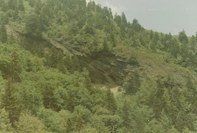
Courthouse Rock


My sons standing in front of a rock about 50' above the Quliams chimney.  I have had people tell me it was a place to store food, a place they housed animals and a place to hide a moonshine still.  I do not know.  The rock slit is not very large and there is a set of stacked stones at its entrance.

Turning to the right at this area follow to trail to a rock outcropping on the right.  Take time to soak in this view!  Look under the rock and you will see this...


There is another rock outcrop to the right at the bend in the trail.  It overlooks Gatlinburg and you can see all the development that is going on.  Pass by that rock and keep on going. 

                             
                                                                        Courthouse Rock


On the edge of Courthouse Rock

Qulliams Cave? Quilliams Rock? Quilliams Falls? What is it exactly?

Just off NFG Road on Road Turn Branch is an interesting set of rocks at the head of ths creek.  I have heard it refered to Quilliams Rock, Cave and Falls.  Wildlife Wilderness Week began taking groups up there a few years ago (but some only to Courthouse Rock) and other guided hikes have been there as well.  Let me take a paragraph and describe what I see.  If you follow Road Turn Branch high up past the Quliliams farm area you will stop at a very large set of cliffs.  Begining on your left, the rocks form out of the ground at the exact top of the valley you are in and the next one to the SW.  At this begining the first rock is just a few feet high and offers you the opportunity to see into both drainages.  Moving to the right the rocks get very high, very fast.  Here the top is probably 20' and gains elevation as you move to your right.  In about 30 yards you will find a rock with an indention in it large enought to have a few people stand under it and be protected from a rainstorm.  Move to your right more and they really take off!  Now we are looking at a cliff that is probably approaching 100' in height with a water fall coming off the top.  The last time I was there was in December '09 after a rain and boy was there a lot of water coming off the top!

The Quilliams Rocks at the far left side

At the water fall you can easily walk behind it with no trouble.   To the right of the water fall there is a shelf some 20' or so off the ground that I climbed upon to take a picture of the "rock house".  The shelf in this rock face is at ground level and has its floor litered with massive slabs of rock that have fallen from apparent "freeze and thaw" method.  However it is a very large room that is unique to the Smokies.  It is also very dry in there.  I could smell the musty, mold odor of a cave.  If you have allergies this place would set them off in a hurry!

Interesting formation at Qulliams Rock area


Quilliams Falls


Quilliams Rock (AKA Cave).

So, what word does one use to describe this area?   Quilliams "Cliffs".   The cliffs have cliffs, a waterfall and a rock overhang.  I did not see a cave.  If there is one would someone please tell me where it is?!


From the very back of the "cave" looking out toward the waterfall.

Little Duck Hawk Ridge

I have been to LeConte about 60 times.  The majority of those trips have been up Alum Cave Bluff Trail.  Between Inspiration Point and Alum Cave Bluff is a great view of a steep, vertical rock formation known as "Little Duck Hawk Ridge," "Kissing Camel Ridge" or "Eye of the Needle."  It is associated with Peregrine Peak which is the large moutain to its NE. Another view is after you pass Alum Cave Bluff the trail makes a turn to the right.  Look to your left through the trees.  You will see a side trail ending at a cable across the trail with a sign.  That is a far as you can legally and morally go. 

Below is the quote from the Great Smoky Mountain National Park of its "Title 36 Code of Federal Regulations , Chapter 1, parts 1-7 authorized by US Code Section 13" with specifics to this area.  Simply put, if you have not made it to Little Duck Hawk Ridge before the closure, you are too late.  Its closed....

Section 1.5 deals with public closures.  Here is the statement:
"Trail and Backcountry closures

The rocky ridge adjacent to the Alum Cave Bluff area,commonly known as: "Eye of the Needle", "Little Duck Hawk", and "Raven's Roost" is closed to public access. The closed area is a narrow rocky ledge that runs in a north/south direction. Closure signs will be posted approximately 100 yards from the junction with Alum Cave Trail along a manway leading to the mentioned ridge. This closure is to prevent disturbance of nesting Peregrine Falcons. The success of Peregrine Falcons in raising their young is significantly decreased by human disturbances. Successful nesting has been observed."

I have seen and heard the falcons!  What a sight.  One day I heard it fly over me before I saw it.  Magnificent!  So, I respect this regulation in defense of the falcons.

Below are a few pics from before the closure. I climbed out to the hole in the rock and took a picture of Alum Cave then went to Alum Cave and took a picture of the hole.  I am glad I did it when I did!


Here is Alum Cave from where I was standing at the hole in the rock at Little Duckhawk Ridge.  Note the hikers standing under the overhang.

Norwood Boiler below Clingmans Dome

When I was growing up I heard about a train that wrecked on Clingmans Dome and rolled down the mountain.  Of course that was a definate legend to chase!  So, a few years ago I found that it was a MYTH.  Here is the story as I know it.  Before 1926 the Norwood Lumber Company clear-cut basically the south side of Clingmans Dome.  I do not know how far down however.  What I do know is that there is a lot of evidence remaining.  Many RR grades, skidder trails, rails, coal, etc. are all over the mountain.  The "train" that is below the Dome is actually a boiler which produced steam to operate a winch to pull logs up the mountain to train cars.  If you have been to the massive piece of metal it is lying in its side.  I saw a picture (which I am trying to get a copy of) that has the boiler standing upright.   When I get a copy I will post it.  Here is the boiler...


As you can see, I am standing on the flat grade.  From the Clingmans Dome parking area take the trail toward Andrews Bald.  Turn right onto Forney Creek Trail. Go about a 1/4 mile and look for a cairn on teh right.  The old RR grade is pretty obvious.  Turn right off Forney Creek trail onto the grade.  You will see rails, coal, etc and then will come upon the boiler.  So, its a MYTH....a train did not wreck on Clingmans Dome!  HOWEVER there is a boiler there!